888-306-2974

Mapping & Surveying

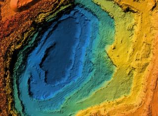
Unmanned Aerial Vehicles (UAVs) open a whole new level of accuracy, speed, and cost-effectiveness when it comes to surveying land and existing infrastructure. FSS drones provide you with highly detailed 3D renderings for inspections, planning, project updates, and easy sharing across the company.

Benefits

Spot potential errors before they occur

Supply remote parties with regular project updates

Easily compare the real site to design plans

Get accurate measurements of all stockpiles

Receive defined details at a fraction of the cost

Specialties

Construction Site Surveying

FSS drones use advanced photogrammetry software to compile hundreds of high-quality images into an accurate 3D rendering of your site and surrounding area. The surveyors use this data to inspect and assess the site, identify and pinpoint the exact coordinates of potential hazards, and ensure mistakes are corrected before they become costly. With drones, FSS can conduct these surveys far more efficiently than traditional surveys, allowing data to be processed and critical decisions to be made without delay. Drones also promote safety by eliminating the need for inspectors to be close to heavy machinery and other construction site hazards.

Inventory Surveys

We understand how long and arduous the process of surveying stockpiles is for mining, aggregate, and construction industries. Even with all the effort put in, expensive mismeasurements are almost a guarantee. FSS is working to change that by using UAVs to capture accurate stockpile information. Drones are able to capture more elevation points of the material pile than traditional surveyors, ensuring that every peak and valley is recorded, guaranteeing incredibly accurate calculation. With more data and a faster turnaround time, your inventory numbers will be more reliable than ever.

3D Modeling

Using drones, we can quickly produce even the most challenging 3D models of existing infrastructure for all types of projects. With our advanced point cloud or photogrammetry software, we quickly create highly detailed 3D reality meshes without the need for expensive, specialized equipment. This provides you with precise, real-world context for all design, construction, and operations decisions throughout the entire project. These renderings allow contractors and partners to take a complete virtual tour, which aids in a rapid turnaround and is especially useful in a time when many buildings have capacity limits. Simply put, these 3D models offer the power to make informed decisions with complete visibility ahead of the project, allowing you to see exact representations of the terrain where you’ll be building, or the existing infrastructure you’ll be renovating.